Author Bio: About Nige
Nige is one of the co-founders of The Billingham Blog and works as a freelance management consultant. He loves to fly in his spare time!
By Nige
on December 16, 2023
at 10:32 pm
Type: Post
Story: Tier Point Run to Palm Springs in Dec 2023
Category: Travel
Tags: Hertz | Hilton | Reviews | SCLA | Southern California Logistics Airport | Trips | USA | Victorville
The Southern California Logistics Airport (SCLA) has become known world-wide as a major airliner boneyard.
Although restricted to the public, there are viewpoints around the airport that allow visitors to see abandoned aircraft.
With a camera/mobile phone and a good zoom, you can get some decent shots of individual aircraft if you so wish. I’ve always wanted to go, but have never had the opportunity until now.
So, this is what I found when I visited in Dec 2023.

Background
The SCLA is located near to Victorville in California on the edge of the Mojave Desert. SCLA is located on the site of the former George Air Force Base.
The George Air Force Base was converted to SCLA to provide major corporations with logistics needs and access to a global logistics gateway to the Western US.
The SCLA has been used extensively during Covid, where airlines stored their active aircraft for extended periods, whilst everyone was in lockdown.
It was also one of the places that was used to hold 737 MAX8 aircraft, whilst that was subject to intense review.
[insert-clear-float]
The SCLA has been used in numerous movies over the years, including Contact, Face/Off, Space Cowboys and Ocean’s Eleven.

Location
SCLA is about 7 miles northwest of Victorville, 50 miles north of San Bernardino and about 90 miles northeast of Los Angeles.
It is located just north of Air Base Road/Air Expressway.
Many of the streets around SCLA are accessible by car, but there are active business and industry areas which are restricted – just follow the signs and don’t go anywhere you shouldn’t!
Note: there are no organized tours are available at SCLA.

Areas of Interest
There are two areas of interest around SCLA if you want to get close-ish to the aircraft stored on the site:
I’ll focus on these two areas separately.
[insert-clear-float]
1. SCLA Main
The immediate area around SCLA is the easiest to access and I’ve been explicit about where the best viewpoints are.

1.1 Driving Route
The driving route I took to reach the main viewpoints can be seen in the image here.
This driving route isn’t complicated, so no need to worry. Everything is easily accessible.
Remember to look for signs and follow any instructions provided by those signs.
E.g. if you come across a sign that says you are not allowed to go any further, then please don’t! You are probably not quite in the place you thought you were!
[insert-clear-float]
A brief summary of the driving instructions is below:

1.2 Viewpoints
That gives you a high-level view of the driving route, but where can you see the aircraft?
The places I found that were easily accessible, with places to park your car for a few mins in order to be able to view aircraft through the fence, can be found in the image here. I’ve labelled these 1-11.
If you have a mobile phone, then you can easily position your lense to look through the gaps in the fence.
If you have an SLR camera, then it’s going to be slightly more difficult, since your lense is likely to be larger.
Some people advise carrying a ladder with you, so you can take photos over the fence. Not sure I would do that to be honest!
[insert-clear-float]
A list of the viewpoints is provided below. I’ve just added a single photo against each one. I took a load more, which you can find at the end of this guide!

Viewpoint 1. Innovation Drive
Heading up Phantom West, the first turn on your left is Innovation Dr.
I drove to the end of the paved road, there’s a fence on the right hand side, just past a building.
I parked my car in the street and I walked up to the fence to have a look what I could see.
Probably not a great deal to see from here, but it was my first opportunity to see some of the aircraft.

Viewpoint 2. Boeing Car Park
Back to Phantom West and I turned left. The next road on the left didn’t look that interesting to me and it’s advertised as Boeing at the entrance, so I drove on past.
The next road on the left, which is opposite Mustang Street provides access to a Boeing parking area. The car park was almost empty when I was there, and there was an active aircraft visible.
I parked up for a few mins so I could take a photo.

Viewpoint 3. Cargo Lane
Back to Phantom West and I turned left. The next road on the left is Cargo Lane, which has an aircraft positioned next to the road.
I turned in here and parked up along the road to take a photo of the aircraft.

Viewpoint 4. Cargo Lane Fence
I carried on up Cargo Lane, right up to the fence at the end of the road.
There were quite a few active aircraft hanging around here.

Viewpoint 5. Main Entrance/Worley Boulevard
Back to Phantom West and I turned left again. I ignored the next road on the left and carried on to Worley Boulevard, which appeared to be the main entrance onto the apron at SCLA.
I parked up nearby on Readiness Street and walked over to the main entrance, where I found some interesting artefacts on display and got some photos of activity on the apron.

Viewpoint 6. Readiness Street Car Park
I stayed on Readiness Street and slowly drove northeast.
About 400 yards up this road, a car park appeared on the left-hand side, with easy access to a large stretch of fencing.
This provided me with a wide view of what’s going on and allowed me to see quite a few abandoned aircraft.

Viewpoint 7. The End of Readiness Street
I got back on to Readiness Street and continued driving northeast until I reached the end of the road.
Turning left around the side of the last building on the left, I found another small parking area.
I parked up and took a couple of shots from this vantage point.

Viewpoint 8. US Army Reserve Preservation Center
From the small car park at the end of Readiness Street, I drove back towards Readiness Street and drove straight across the street. I followed my nose, bending around a building to the left.
That took me to the US Army Reserve Preservation Center and on this side of that building, there’s a road to the left that provided access to the fence and another small parking area.

Viewpoint 9. Aviation Drive
I headed back onto Phantom West and drove eastwards until I reached the junction of Phantom East and Perimiter Road.
I turned left and drove just beyond High Desert Power and turned left on to the dirt track.
All of this area provides a good overall view of SCLA and I got my first view of the large boneyard, accessible from the north.
There is apparently a road in this area called Aviation Drive, but it isn’t easily identifiable on the ground. This whole area is just dirt, but it’s easily drivable.

Viewpoint 10. Aviation Drive
Staying in the same general area, I drove a little further up Aviation Drive and took some more photos from this slightly elevated position.

Viewpoint 11. Adelanto Road
The only other place worth spending a few mins at to take a photo or two is to the west of SCLA.
I drove back to Phantom East and then turned right to retrace my steps.
Once I reached the Air Expressway, I turned right and drove a couple of blocks to Adelanto Road, where I turned right.
A short distance up there, I saw some parts of abandoned aircraft on the right-hand side.
[insert-clear-float]
That was about it for me in the main SCLA area.
[insert-clear-float]
2. SCLA North
The SCLA North area holds the largest number of abandoned aircraft at SCLA.

2.1 Driving Route
The driving route I took to reach the north of SCLA can be seen in the image here.
This driving route is fine until I reached point F, where I joined Colusa Road. This was all dirt track/gravel.
I found it ok, and I was prepared to take the risk, but others may not be so gung-ho!
If you break down on a dirt track road, a rental company may not look very favourably on coming out to rescue you!
[insert-clear-float]
A brief summary of the driving instructions is below:

2.1 Viewpoints
I haven’t made a note of any specific viewpoints on this northern section of this guide.
I stopped at numerous places along the sand track along the top of the northern fence, walked up to the fence and took photos. I’ve included a few below:
These aircraft are the first to be visible from Topaz Road on the right hand side.

Once I reached the fence at the north end of SCLA, I had to follow the sandy track around to the left.
The track continues alongside the boneyard for about half a mile.

There’s a real mix of abandoned aircraft at SCLA – it makes for an amazing view with the desert backdrop.

By the end of the fence on the north side of SCLA, I had seen enough of abandoned aircraft.
I was now more focused on getting back to the road, which was 3.5 miles away across more sand/dirt/gravel track.
I needn’t have worried too much. I took my time and my rental car breathed a big sigh of relief when I got back to Highway 395.
[insert-clear-float]
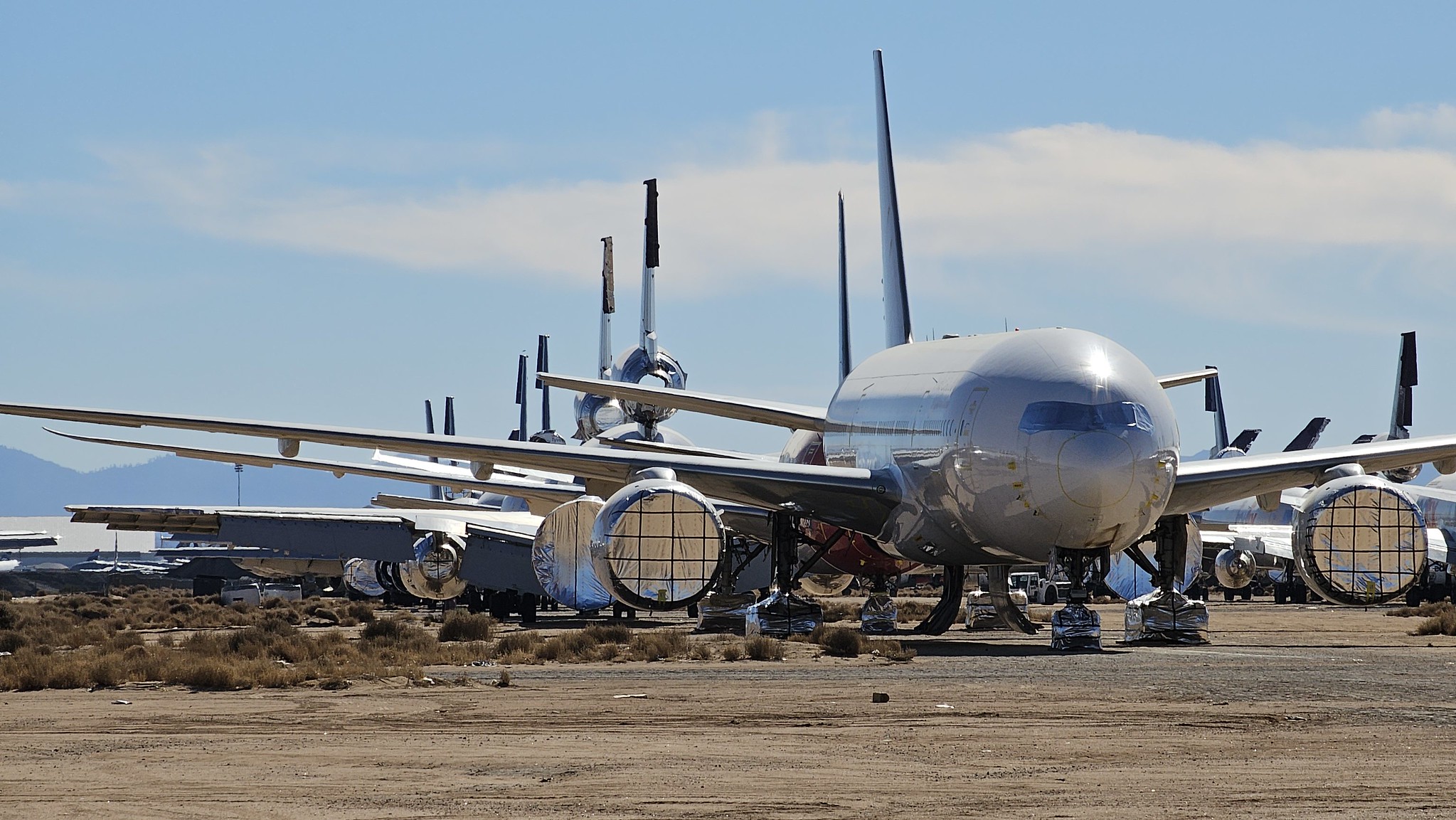
All Photos from My Visit
Summary
That concludes my visit to the SCLA boneyard in Dec 2023. It was a real experience for me. Interestingly, I didn’t see anyone else doing the same thing as me on the day I visited. If you have half an interest in aircraft, this is well worth a visit.
Author Bio: About Nige
Nige is one of the co-founders of The Billingham Blog and works as a freelance management consultant. He loves to fly in his spare time!

Leave A Comment